All of the Google Geo tools have countless meaningful uses for learners of any age! So many of our students don’t have opportunities to experience the world outside of their community. Exploring the world using Google’s Geo tools gives students a peek into life beyond the four walls of their classroom. We empower our learners then we offer them a global perspective.
Many teachers underestimate the potential of these tools with our littlest learners. Some fear that it’s too difficult for primary aged students, and others just don’t know where to begin! They can do it though! #K2CanToo!
One simple tool that is especially useful to get our youngest students creating and connecting themselves to the world is Google My Maps, which is available right from your students’ Google Drive.
Primary Uses for Google My Maps:
Kindergarten students can learn about their community, state, country, and world!
You can map the cultural heritage of the students in the class, offering a visual representation for students to begin exploring similarities and differences.
 |
| Marjorie Priceman. Dragonfly Books, 1996 |
Summarize literature by retelling places visited by characters in a story. In this story read in first grade, the main character soars around the world collecting ingredients to make an apple pie. She visits Vermont to pick apples, and Jamaica to gather sugar cane.
Little Learner Tips:
In the beginning, model, model, model! The first few might be done as whole-class activities. One example of this is a first grade class that uses My Maps every time they read a text that mentions location. By the end of the school year, they had visited 86 places through reading!
Have younger students draft their entries on a post-it, and then an adult can type in the content, until the kiddos have the process down! Don't rely on this option for too long - give them a chance, because they can do it! #K2CanToo!
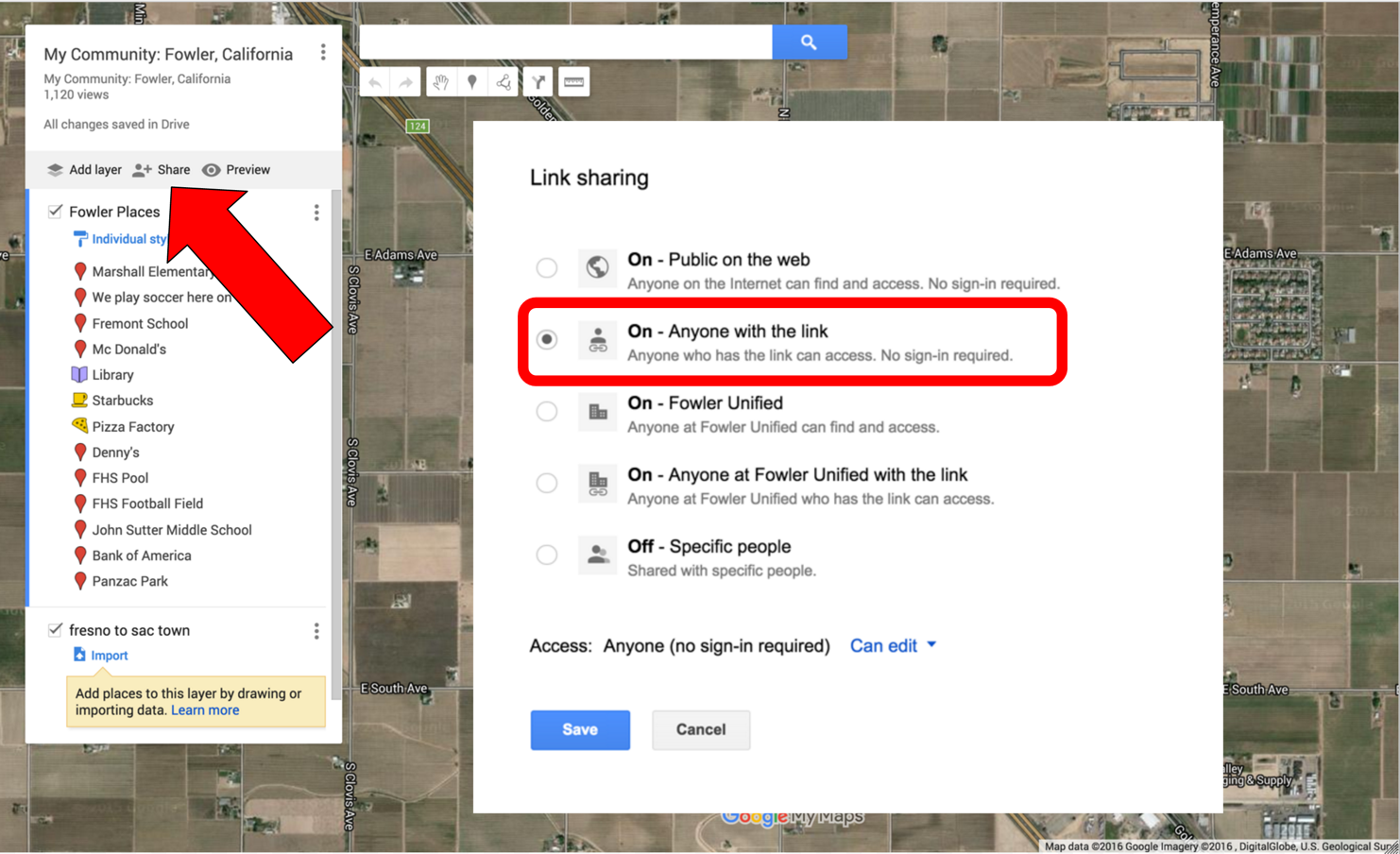
For classroom collaborative maps that have each student adding their own entry on a single shared map, post an editable link in your Google Classroom. In the sharing settings of the map, choose “anyone with the link can edit,” or limit it to anyone in your domain.
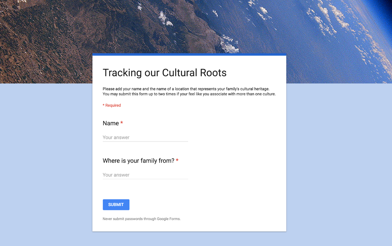
Another collaborative option might have students fill out their information on a simple simple Google Form that has some basic short answer questions, such as name and location.
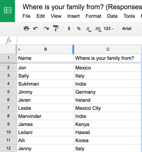
You can then import the form’s spreadsheet data as a layer on a map. Here’s a YouTube tutorial on how to do this by Richard Byrne.
Google My Maps - A Beginner's Guide

A number of beginning My Maps tutorials can be found on YouTube to help you get started. I hope you enjoy using Google My Maps with your primary-aged students. Please share what they create!
Google My Maps - A Beginner's Guide

A number of beginning My Maps tutorials can be found on YouTube to help you get started. I hope you enjoy using Google My Maps with your primary-aged students. Please share what they create!
Wonderful examples and ideas! Thank you!!!
ReplyDeleteLove these ideas! Thank you so much! I'm going to try to use Google Maps next week!
ReplyDelete